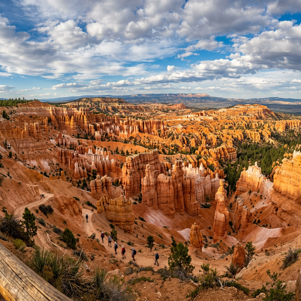

After spending two days at Zion National Park sweating while hiking, we headed to Bryce National Park in Bryce, Utah where the elevation rises up to 9,100 feet elevation. A nice change of pace hiking in the cooler temperatures! The national park is famous for Hoo-Doos which are irregularly-eroded rock spires. Established 1928 and location is 37.5930 degrees North by 112.1871 degrees West.
Getting Around
Bryce Canyon has a free shuttle service that can you pick you up from the following hotels: Old Bryce Town, Best Western Grand, Best Western Ruby’s Inn, Ruby’s, and Bryce Lodge. The shuttle service has the following steps in the park:
- Bryce Point
- Inspiration Point
- Sunset Point
- Sunrise Point
When to Go
If you only have 1-3 hours at the park, visit Bryce Amphitheater, Rim Trail, Queens/Navajo Combination Loop. If you have 4+ hours to spend at the park, visit Southern Scenic Drive, Figure 8 Combination, and Mossy Cave. Best time to visit Bryce Canyon is between April-October.
Hiking
Although there are many things to do at the park, hiking is by far the most popular. The hiking trails are split up by easy, moderate, and strenuous. Remember to bring appropriate shoes and stay hydrated by bringing water.
Easy Hikes
- Mossy Cave – .8 mile hike with an elevation of 150 feet.
- Sunset to Sunrise – 1.0 hike with an elevation of 40 feet (easiest hike)
- Rim Trail – 1.0 mile to 11.0 miles hike with an elevation of 719 feet. The Rim Trail goes through BrycePoint, Inspiration Point, Sunset Point, Sunrise Point or Fairyland Point. The Bryce to Inspiration section is closed in the winter.
- Bristlecone Loop – 1.0 mile hike with an elevation of 200 feet. (Rainbow Point or Yovimpa Point.
Moderate Hikes
- Queen’s Garden – 1.8 mile hike with an elevation of 450 feet. (Sunrise Point) We tried this one and not for the week of heart!
- Navajo Loop – 1.3 mile hike with an elevation of 515 feet (Sunset Point). Counter clockwise direction recommended.
- Queen’s/Navajo Loop – 2.9 mile hike with an elevation of 625 feet (Sunset or Sunrise Points) Counter clockwise direction is recommended. Use Two Bridges side of loop in winter when the Wall Street side is closed. (Most recommended hike)
- Tower Bridge – 3.0 mile hike with an elevation of 760 feet (North of Sunrise Point)
- Swamp Canyon Loop – 4.0 mile hike with an elevation of 800 feet. Counter clockwise recommended. This is a forested back country hike.
Strenuous
- Hat Shop – 4.0 mile hike with an elevation of 1,380 feet. (Bryce Point)
- Fairyland Loop – 8.0 mile hike with a elevation of 1,900 feet. (Fairyland Point or north of Sunrise Point)
- PeekaBoo Loop – 5.5 mile hike with an elevation of 1,560 feet. (Bryce Point) Descend 670 feet from Bryce Point to the hoodoo filled loop before ascending back up to Bryce Point. Clockwise direction recommended.
- Navajo/PeekaBoo Combination Loop – 4.9 mile hike and elevation of 1,475 feet.(Sunset Point) Use Two Bridges side of Navajo in winter.
- The Figure 8 Combination – 6.4 mile hike with an elevation of 1,575 feet. (Sunrise and Sunset Point) Clockwise direction recommended.
- Bryce Amphitheater Traverse – 4.7 mile hike with an elevation of 1,145 feet. (Bryce Point)
- Last four trails can be on horse-back.

Maps


Other Activities
- Backcountry Camping
- Horseback Riding
- Pets-Only allowed on paved areas
- Bicycling
- Night Skies at Inspiration Point
- Snowshoeing – 14 inches of snow required.
- Cross-country skiing – 14 inches of snow required.
- Wildlife Viewing
- Full-moon hikes – Through Ranger Program for ages 8+.
- Christmas Bird Count and July Butterfly Count – Through Ranger Program.
- Bryce Canyon Lodge and Restaurant – Open from Spring -Fall
Mountain Goats
As we are heading back through the mountains, we got a surprise of mountain goats walking down on the shoulder of the road. A cool surprise!


Gallery





Leave a Reply