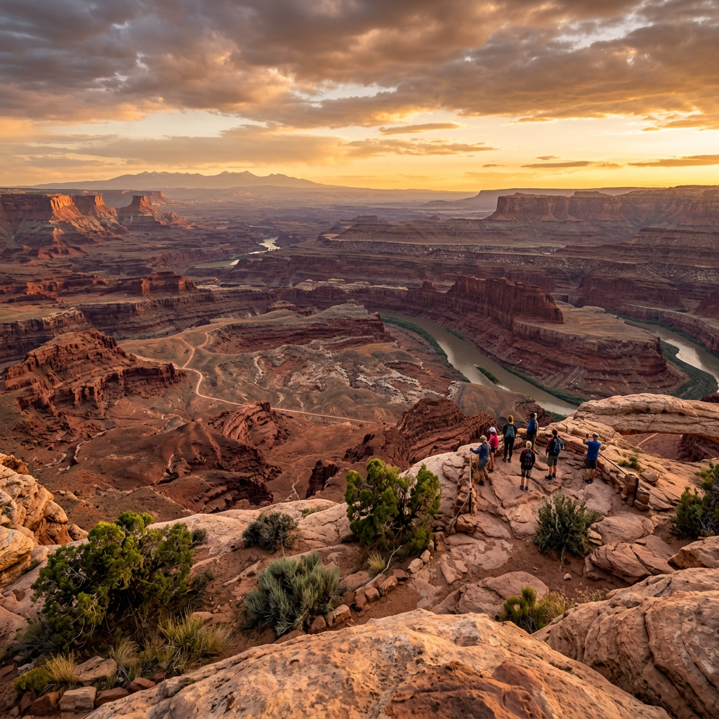

After leaving Capitol Reef National Park, the next couple of days were spent at Canyonlands National Park. This national park is a 2-day park while Capitol Reef National Park was a 1/2 day park. Canyonlands National Park is a wilderness of rock that is split into 4 different areas. The park was established in 1964 and is located at 38.2136 degrees North, 109.9025 degrees West.
Areas of the Park
- Island in the Sky
- The Maze
- The Needles
- The Rivers

Island in the Sky
Once at the Island in the Sky, views reach from the Green and Colorado rivers to the mountaintops. Across the canyon, views reach the horizon 100 miles in the distant. Between the two rivers is an observation tower. You can see White Rim which has a white sandstone bench 1,200 feet below the Island. Another 1,000 feet below White Rim are the rivers which shadow cliffs. Beyond that lie the Maze and the Needles. sections of the park.
Coyotes, squirrels, ravens, hawks, and small birds share the land’s food. Trails around Island in the Sky are good places to see wildlife. Upheaval Dome is the oddest formation. It is 1,500 feet deep that takes the shape of a crater instead of a dome. Theory suggest the shape was the result of a meteor strike. There is a beautiful Mesa Arch that during sunrise shows the valley below. Two other overlook formations that are worth viewing are Grand View and Shafer Canyon.
The Maze
The Canyonlands National Park most remote area is The Maze. The area is a 30 square mile puzzle in sandstone. The areas are The Land of Helping Rocks, Ernies Country, The Doll House, and The Fins which have oddly shaped towers. There is a 600 foot descent into The Maze canyons. Part of the canyons include Horseshoe Canyon Unit that has significant pictographs. The Great Gallery has panels that has life-sized figures left by Archaic people 2,000 years ago. No water is available in this remote area.
The Needles
The Needles is a diverse area that includes Devil’s Kitchen, Angels Arch, Elephant Hill, Caterpillar Arch, Gothic Arch, and Paul Bunyans Potty. These landforms have spires, arches, canyons, and potholes to surprise you. In contrast to the bare rocks are grassy meadows of Chesler Park. Most of the arches lie in the back country so you will have to extend your hike through Elephant Hill which is not for the faint of heart!
The design of some of the structures mirror the dwellings of Mesa Verde (stay tuned for that future blog post). These areas are important to the indigenious culture and looters have taken many artifacts. Please leave all the artifacts undisturbed just like you found them. Check out the Stone Storehouse, Cave Spring, and Pothole Point as they provide unique experiences.
The Rivers
At the confluence of the Green and Colorado rivers, the waters flow through sheer walled canyons. There is a 14-mile rush through Cataract Canyon rapids. This is one of the nation’s most treacherous rapids that rival The Grand Canyon. The rivers are both quiet and challenging. Boating is popular above and below the confluence. You can access the rivers near the towns of Green River and Moab.
Picture Gallery


Travel Information
Climate
- Summer-Day 80-100 degrees and Night 50-60 degrees.
- Spring and Fall-Day 60-80 degrees and Night 20-50 degrees.
- Winter-Day 30-50 degrees and Night 0-20 degrees.
Exploring on Your Own
- By Road-Paved and 2-wheel vehicles in the Island in the Sky and 4-wheel vehicles in The Needles.
- By Trail-Short and Long Hikes.
- By River-Motorboats, Rafts, and Canoes
- Guided Tours
- Campgrounds
- Safety-Bring 1 gallon of drinking water per person/per day.
Enjoy the trip!




Leave a Reply